
Central Tunisia
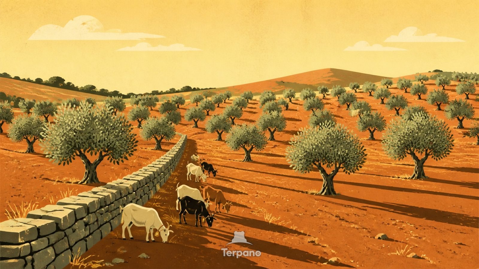
This scene is an original illustration set in Central Tunisia. It lies in mid-latitudes, where the climate is mediterranean — hot dry summers, wet winters.
Rows of silvery-green olive trees run in a loose grid across the midground and up the far slope. Red-ochre tilled earth shows between them. A low dry-stone field wall cuts diagonally through the foreground, and a small herd of goats browses along it. Every tree throws a long parallel shadow across the ground.
Why do olive groves only grow in this narrow climatic band?
Olives tolerate drought and poor soil but not hard frost, which puts this grove in a narrow climatic band around the Mediterranean and its dry margins. The wide spacing is a water strategy — each tree needs its own catchment. Dry-stone walls without mortar are what you build where stone is the surplus and timber is not. The long shadows place the hour late in the afternoon.
Terpano is a free daily geography puzzle. You study one original illustration, place a pin on a borderless terrain map, and see how close you were. There is no account and no sign-up; progress stays in your own browser. It plays in 11 languages.
Part of Working landscapes — A working landscape shows you what the land can be made to yield, and at what cost.
Play this puzzle Play today's puzzleMore puzzles in a similar climate
 Sicily, ItalySicily, Italy
 Honeycomb Coast RockMediterranean Granite Coast
 Colosseum Arches in Mediterranean LightColosseum, Rome, Italy
 Cone-Roofed Stone HutsPuglia, Italy
English · Deutsch · Español · Français · Italiano · Português · Русский · 简体中文 · 繁體中文 · 日本語 · 한국어