
Rice Polders behind Mangrove Dikes
Cumbidjã River, Tombali, Guinea-Bissau
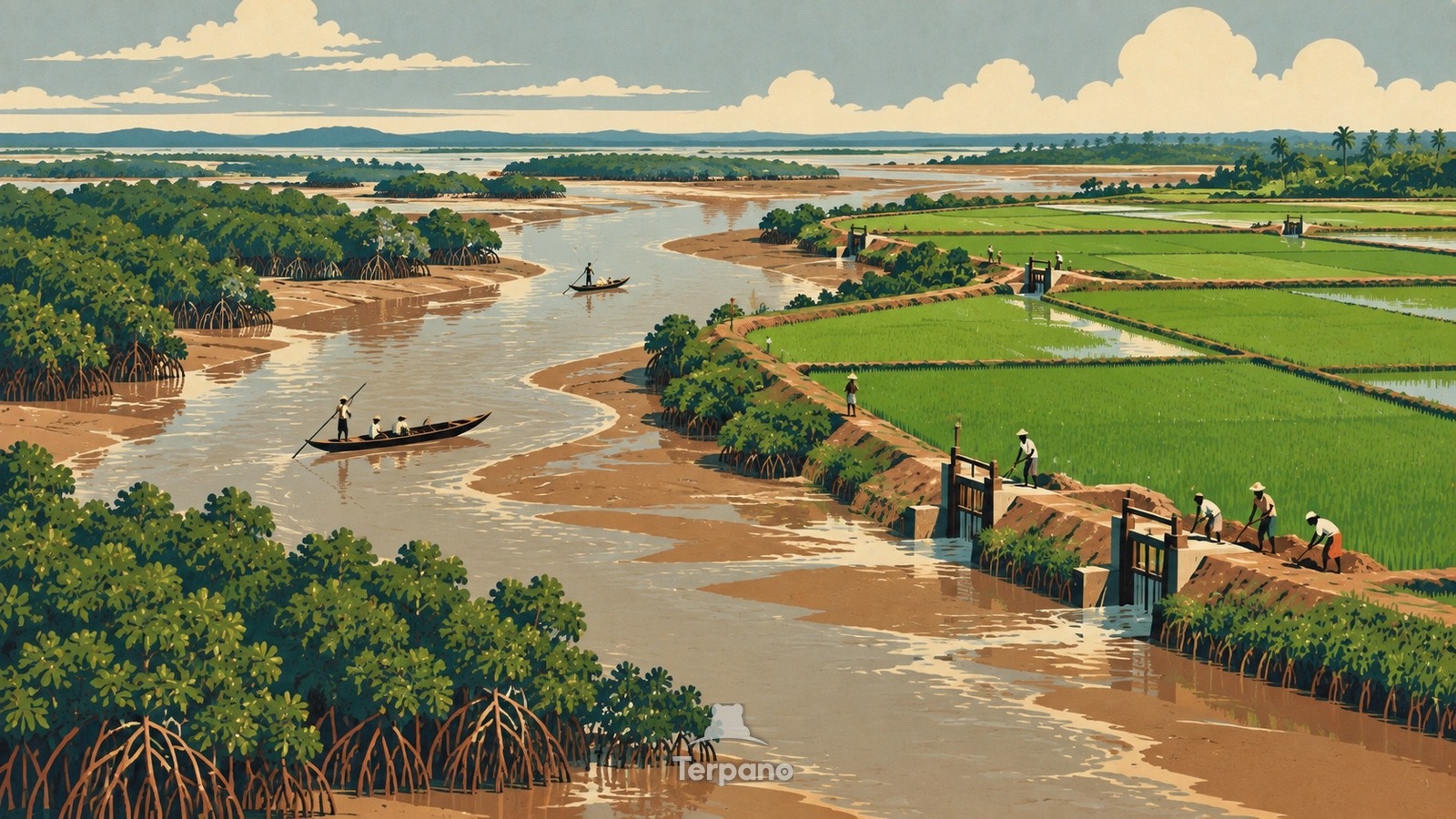
Rice Polders behind Mangrove Dikes is an original illustration set in Cumbidjã River, Tombali, Guinea-Bissau. It lies in the tropics, where the climate is tropical monsoon — a short drier season inside a wet year.
Rectangular green rice plots sit just behind long hand-built earthen dikes along a broad tidal creek. Wooden sluice gates interrupt the embankments, dark mangrove roots line the brackish channel, farmers repair one low wall, and a patchwork of wet fields extends across the nearly level coastal plain.
Why are rice fields sealed behind dikes beside a tidal mangrove river?
Mangrove soils are fertile but tidal salt water would kill rice, so farmers enclose bolanhas with anti-salt dikes and manage gates to drain rainwater while excluding the returning tide. The flat estuary makes large fields possible yet leaves almost no natural elevation, turning every breach into a threat and repeated maintenance into part of cultivation. Mangrove fringe, tidal creeks, rectangular polders, and hand-worked dikes reveal Guinea-Bissau's coastal rice system.
Terpano is a free daily geography puzzle. You study one original illustration, place a pin on a borderless terrain map, and see how close you were. There is no account and no sign-up; progress stays in your own browser. It plays in 11 languages.
Part of Ice, tide, river and salt — Water leaves marks at a scale you can measure by eye.
Play this puzzle Play today's puzzleMore puzzles in a similar climate
 Coral-Stone Trading AlleysStone Town, Zanzibar, Tanzania
 Monsoon Chawl CourtyardMumbai Metropolitan Region, India
 Rice Fields Below the CanalsKuttanad, Kerala, India
 Coastal Train below a Cloudy PassHai Van Pass, Vietnam
English · Deutsch · Español · Français · Italiano · Português · Русский · 简体中文 · 繁體中文 · 日本語 · 한국어