
High-Stilt Floodplain Village
Tonle Sap Floodplain, Cambodia
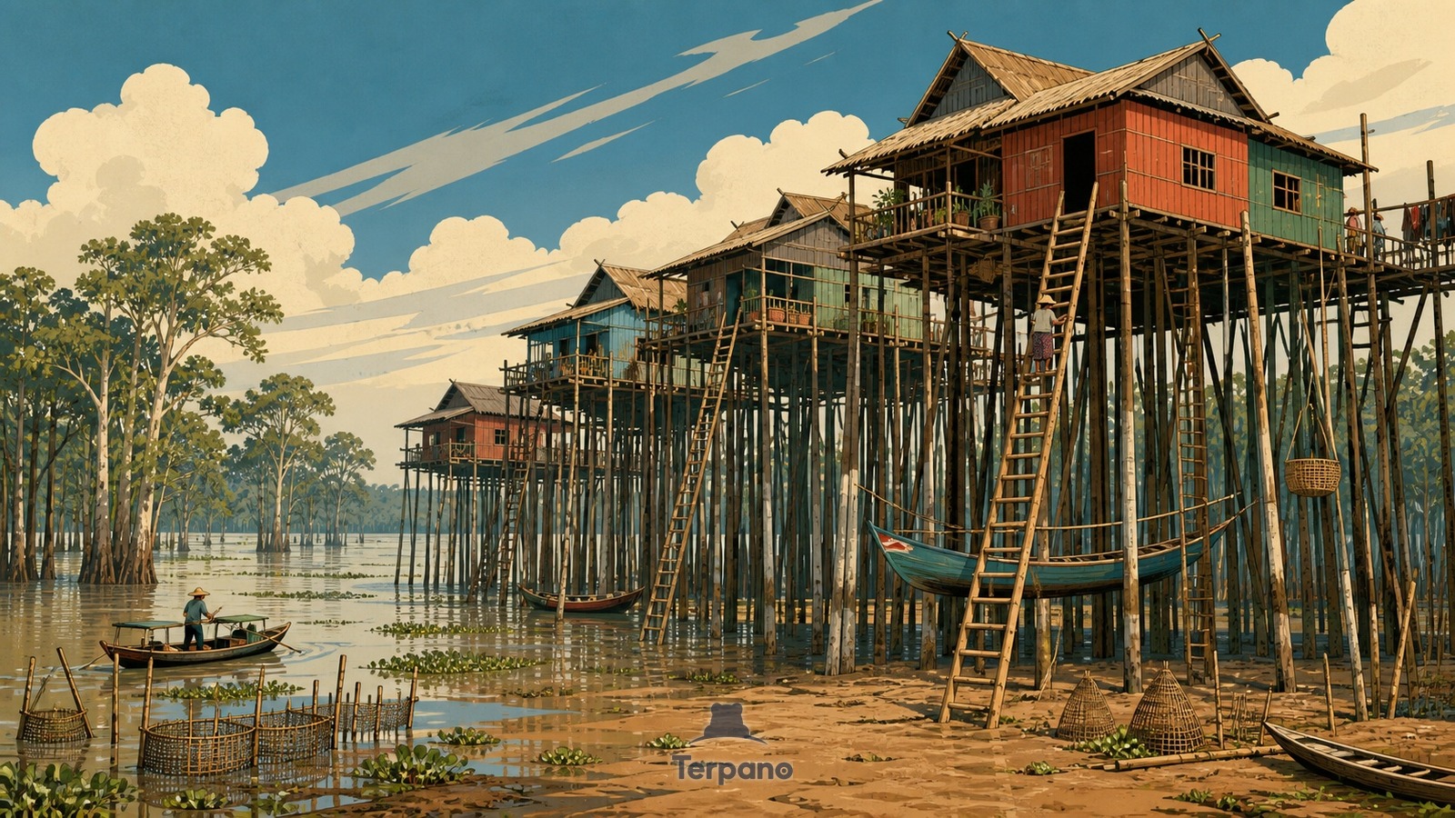
High-Stilt Floodplain Village is an original illustration set in Tonle Sap Floodplain, Cambodia. It lies in the tropics, where the climate is tropical savanna — a pronounced dry season.
Timber houses perch on extremely tall slender stilts above a broad muddy floodplain, with long ladders reaching doors and boats tied at several heights. Receding water leaves wet marks on posts, floating vegetation in channels, and flooded forest trees beyond; fish traps and raised walkways connect the settlement.
Why do houses stand on stilts far taller than their rooms?
Monsoon flow from the Mekong reverses into Tonle Sap and can expand the lake many times beyond its dry-season footprint, so a shoreline settlement must work at radically different water levels. Tall stilts keep rooms above the annual rise, ladders and moorings shift with the water, and boats replace roads during inundation. Flood marks, gallery forest, fishing gear, and exaggerated stilts all follow the lake's seasonal pulse.
Terpano is a free daily geography puzzle. You study one original illustration, place a pin on a borderless terrain map, and see how close you were. There is no account and no sign-up; progress stays in your own browser. It plays in 11 languages.
Part of Ice, tide, river and salt — Water leaves marks at a scale you can measure by eye.
Play this puzzle Play today's puzzleMore puzzles in a similar climate
 Mekong Delta, VietnamMekong Delta, Vietnam
 Wat Arun beside Bangkok's River TrafficWat Arun, Bangkok, Thailand
 Delta Braid NetworkGanges Delta, Bangladesh
 Mangrove ChannelsSundarbans Delta, Bangladesh
English · Deutsch · Español · Français · Italiano · Português · Русский · 简体中文 · 繁體中文 · 日本語 · 한국어