
Reservoirs Stepping down a Dry-Zone Valley
Palugaswewa Tank-Village System, Sri Lanka
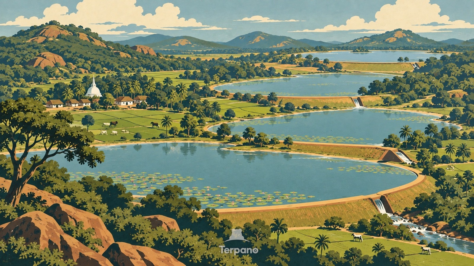
Reservoirs Stepping down a Dry-Zone Valley is an original illustration set in Palugaswewa Tank-Village System, Sri Lanka. It lies in equatorial latitudes, where the climate is tropical savanna — a pronounced dry season.
From a high oblique view, several shallow village tanks step down one winding drainage line through dry-zone woodland. Earthen bunds hold lotus water, overflow spills toward the next basin, paddy fields occupy the damp valley floor below each tank, and tree belts separate hamlets, grazing ground, and cultivated plots.
Why do many small reservoirs form a chain instead of one large lake?
A cascade stores irregular monsoon runoff repeatedly as water descends a small catchment: an upper tank slows and settles flow, its excess feeds the next, and sluices release water to paddies below each bund. Forest strips reduce erosion, vegetated seepage zones intercept salts, and connected tanks spread drought risk among villages. That sequence of water, bund, paddy, and tree buffer is the dry-zone tank-village logic of Sri Lanka.
Terpano is a free daily geography puzzle. You study one original illustration, place a pin on a borderless terrain map, and see how close you were. There is no account and no sign-up; progress stays in your own browser. It plays in 11 languages.
Part of Ice, tide, river and salt — Water leaves marks at a scale you can measure by eye.
Play this puzzle Play today's puzzleMore puzzles in a similar climate
 Central Sri LankaCentral Sri Lanka
 Mangrove ChannelsSundarbans Delta, Bangladesh
 Delta Braid NetworkGanges Delta, Bangladesh
 Wat Arun beside Bangkok's River TrafficWat Arun, Bangkok, Thailand
English · Deutsch · Español · Français · Italiano · Português · Русский · 简体中文 · 繁體中文 · 日本語 · 한국어