
A Flooded Forest at the End of the Andes
Tierra del Fuego, Argentina
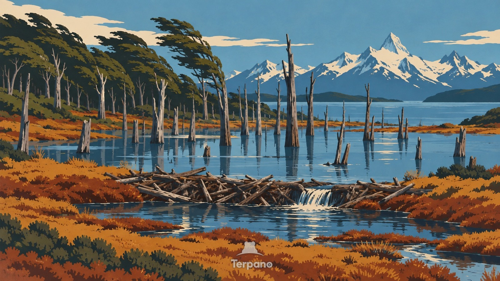
A Flooded Forest at the End of the Andes is an original illustration set in Tierra del Fuego, Argentina. It lies in mid-latitudes, where the climate is subpolar oceanic — cool summers, few frosts.
Wind-shaped southern beech trees lean above a peat-dark valley where a low beaver dam has spread shallow water through the forest. Gray dead trunks stand in the flooded basin, bog plants occupy the margins, and sharp snow-dusted mountains rise across a cold channel.
Why are gray dead trees standing in a flooded southern forest behind a low dam?
Beavers introduced to Tierra del Fuego build dams in a landscape where native trees did not evolve with their flooding and cutting. Waterlogged roots kill Nothofagus stands, ponds expand across peat soils, and drainage patterns change long after the animals move on. The damaged forest, treeless bog edge, subpolar wind forms, and final Andean peaks reveal an ecological invasion near South America's southern tip.
Terpano is a free daily geography puzzle. You study one original illustration, place a pin on a borderless terrain map, and see how close you were. There is no account and no sign-up; progress stays in your own browser. It plays in 11 languages.
Part of Ice, tide, river and salt — Water leaves marks at a scale you can measure by eye.
Play this puzzle Play today's puzzleMore puzzles in a similar climate
 Condors Above Patagonian CliffsSouthern Patagonian Andes, Chile
 Wind-Pruned TreesFalkland Islands Uplands
 Basalt Column CoastSouthern Iceland Volcanic Coast
 Turf-Roofed FarmsteadSouth Iceland
English · Deutsch · Español · Français · Italiano · Português · Русский · 简体中文 · 繁體中文 · 日本語 · 한국어